Fast forward a bit to 7/24…
I sit on a large boulder on the side of Lake. The sun peaks over the trees, almost too hot. The occasional cloud floats into the dazzling rays, the cooling effects immediate. The sweet sucking bee flies whine with an intensity only insects can know. A break in the whine as one lands, probing my skin with its proboscis. Nothing but a tickle – none bite. Just above the water clouds of midges float haphazardly. The occasional fish breaks the surface, darting to grab its unlucky prey.
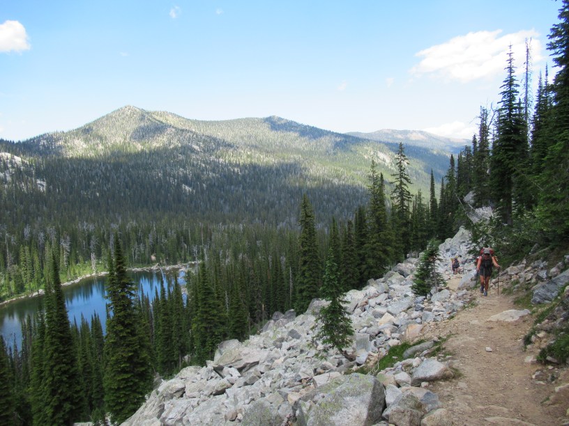
To the south looms a large cliff. A boulder field fed by its steep slope crouches below. The breeze is light, sometimes kissing the lake, creating tiny ripples and ruffling the pine bough border.
The shadows grow on the far side as the sun sinks, nearly touching the tops of the pines. Soon they will reach this side, ending the baking this land today.

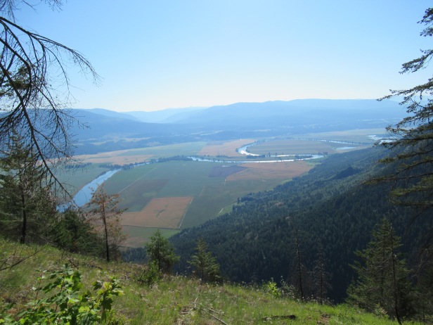
Today started early with the goal of getting most of our climbing done in the coolness of the morning. Switchback after switchback we made our way up, watching Bonners Ferry become increasingly small as we climbed away. By now we came to expect the unexpected – and another bushwhack ahead made it difficult to gauge how long this section would take us. As a result, our packs were fully loaded with food to get us to Metaline Falls and water to get us to the next source, under the worst case scenarios (we hoped).
The trail was dynamic: sometimes exposed, sometimes forested, sometimes burned, occasionally with rabid mosquitoes. I’m still in awe that we can run a mosquito gauntlet when there is supposedly no water on trail for 16 miles.
Deciding our course of action was difficult, as stopping at our first lake and off-trail water source would make the looming bushwhack in the middle of this section too far to hit with time to complete it tomorrow, but pushing onward would make for too long of a day today. As we had known that this lake was here, we had been drinking our water (climbing and heat does that) and the only spot to replenish it was a steep 0.6 miles down – and back up again, if we decided to continue.
After considering our options, and the new information that Katherine had decided to leave the trail at the earliest convenience, we decided to cut it short today and tomorrow, to hit the bushwhack fresh the day after. After miles without lakes, I was happy not to blow past them and to enjoy our time together before the Katherine left.

7/25 Selkirks Lite
There was no reason to go fast today, with a definite endpoint and no shortage of beautiful views. Midway through the morning we came upon a boy scout group – we heard them long before we saw them.
When we came upon the jolly youths sprawled along the trail, with gear haphazardly strewn as they indulged in a gorp and water break.
“Where did you come from?” they asked.
“We started in Glacier National Park.” Jen answered.
The boy’s mouth fell open.
“How heavy are your packs?”
“Not as heavy as yours.”
And we continued on our way.


After passing another boy scout group (again, we heard them long before we saw them – this one had a youth that yipped like a puppy) we had a splendid lunch at Pyramid Lake. Jen found the most perfect lounging rock, and we all tried it out before the final 1.5 miles to where we were going to camp for the night.


We reached our camp early in the afternoon, with ample time for a swim in the perfect alpine lake and dry off in the breezy sun. After an early dinner, we hit our sleeping pads early, preparing ourselves for the looming adventure the next day.
7/26
Bushwhack day! The day we had been looking forward to with excitement and apprehension. The information given on our map was bleak: either take the high route and deal with scrambling at a more difficult level than our previous experience (which was technical enough for our group) or take the longer low route, bushwhacking along a stream (we had been told it was very thick and buggy) with the bonus of possibly running into a grizzly. Both sounded pretty fun – it was difficult to choose.


We started this bushwhack with a scramble too, but this time we were ascending and were rested, making us much more coordinated. We reached the ridgeline and were able to follow it easily.
Then the decision – stay high or go low? We opted for the low road, staying within the comfort and skill level of our group. Thick at times, and requiring some problem solving, we descended to the the creek we would follow to its confluence with another, which we would then follow to the trail. It seemed easy enough.

As expected, we ran into thick bushes, downed trees, slippery stuff. Occasionally we would find a trail that we’d follow for a hundred yards or so before it would disappear completely, only to pop up again a few hundred yards later on the other side.
It was slow going, and with crossing back and forth and climbing over trees, we all fell at some point. Eventually we came to an open spot that the app and GPS said was the end of the bushwhack – except that it really wasn’t, as the trail wasn’t maintained and was so overgrown it essentially wasn’t there.
Ever so slowly the trail grew in strength until suddenly we found ourselves amid day hikers. With wild eyes, wet and torn clothing, and twigs stuck in nearly every orifice, we were as surprised to see them as they were to see us. We continued down the clear trail now, reeling at the strangeness of it – where did all of these people come from?


This area was popular as it touted natural water slides and, apparently, was not far from a parking area. Still stunned by the shear contrast of the wilderness to the day-hike bonanza, we tried to scoop water in a spot that seemed like less people had been swimming in it. It really was an incredible place – you could hardly blame them.
Our trail camp was indeed on the trail, but legit in that it even had a fire ring. Day hikers gawked as they walked past us, one couple made sure that we knew that we should be purifying our water, and one kind family took our trash.
Slowly the area cleared of day hikers and by dusk we had it mostly to ourselves. As the water rushed over the smooth granite I felt lucky that we had made it through yet another bushwhack unscathed, and sad that Katherine would be leaving us soon.
Thanks goes to the PNTA for the maps!

“With wild eyes, wet and torn clothing, and twigs stuck in nearly every orifice……” Must have been a grand day!
LikeLiked by 1 person
I was a grand day! Plenty of adventure – and no injuries!
LikeLike